
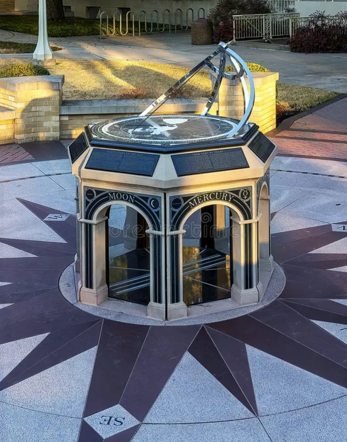
 Texas Christian University (TCU) in Fort Worth Texas unveiled a new longitude sundial on May 5th, 2015. As William Andrewes, creator of the longitude dial explains, "The Longitude Dial" is based on an idea proposed in 1607 by Franz Ritter of Nuremburg...Ritter devised and published a world map projected from Nuremburg, with its lines of longitude arrayed to serve sundial as hour lines. However, the difficulties of creating a new project for each location and the expense of producing it in durable materials were considerable. Ritter's gnomonic projection map does not appear to have been developed for use in sundials - until now."
One of Andrewes sundials will be unveiled in front of Walsh Performing Arts Center, situated in the middle of a circular stone plaza. Andrewes monumental sundial prices start at $50,000. Read more at https://magazine.tcu.edu/latest-news/new-sundial-landmark-unveiled-on-campus/
As an interesting side note, the gnomonic project map upon which Andrewes creates his sundials was extensively used during World War II and into the 1950's by high frequency (HF) direction finding (DF) sites. On the gnomonic map not only are lines of longitude straight, but any great circle line of bearing is straight as well. Using a pin on the DF site, the lines of bearing could be drawn with an extended piece of string. Computer calculations eventually replaced the manual direction finding and geolocation method.